You are using an out of date browser. It may not display this or other websites correctly.
You should upgrade or use an alternative browser.
You should upgrade or use an alternative browser.
A few fine days in the woods
- Thread starter Natch
- Start date

Help Support Brothers of Briar:
This site may earn a commission from merchant affiliate
links, including eBay, Amazon, and others.
alfredo_buscatti
Well-known member
- Joined
- Dec 17, 2007
- Messages
- 2,217
- Reaction score
- 0
That was great! Glad you had a chance to do this! Is your girlfriend upset with you about not putting the toilet seat back down?

$6.99 ($19.97 / Ounce)
Herbal Smoking Blend - Drag (Blend of Exotic Flowers and Herbs) 10grams (0.35oz) (Vibe)
DragStore

$9.99
Loftus International Detective Sherlock Hat & Pipe 2pc Accessory Kit Grey One Size Novelty Item
Rock Ridge Retail, LLC

$4.59
$5.99
Audrey Style Vintage Extendable Cigarette Holder in Black Inspired by BAT's
Getchance

$14.95
Airtight Glass Herb Stash Jar with Clamping Lid in Choice of Design (Metallic Silver/Purple, Small)
Ted Miller Innovations

$18.45 ($6.15 / Count)
Peace O' Mind Herbal Blend - Chamomile, Red Rose Petals, Lavender | Natural Caffeine Free Tea, Herbs for DIY Projects by Tree Fifty Four | 3 Ounces
Tree Fifty Four

$6.99 ($0.70 / Count)
10 Floral pre-Rolled Smokes - Drag - Rose | 100% Organic, sourced from The Alpine Forests of The Himalayas | Herbal Cigarette
DragStore

$8.00 ($8.00 / Count)
Nirbelo Roll Your Own Green Apple Flavoured Herbal Raw Mixture, 100% Tobacco Free & Nicotine Free for Quit Smoking, 35 Gram, Pack of 1
NIRBELO USA

$12.99 ($6.50 / Ounce)
Astral Plane-Herbal Smoke Blend-Organic Mullein-Sacred Ceremonial Blend-Nicotine/Tabacco Free Smoke Blend-100% Natural
Divine Botanica LLC

$12.99 ($1.18 / Count)
MUXIANG Tobacco Pipe Ebony with 9mm Filter 10 Cleaning Pipe Tools AC0035
XIAOXIONGCRAFTS
Great pics. Thanks for sharing Mr Natural!
Cheers,
RR
Cheers,
RR
beetlejazz
Well-known member
- Joined
- Aug 17, 2012
- Messages
- 691
- Reaction score
- 0
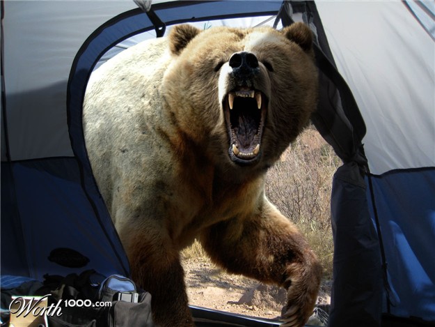
Waaah so pretty!  I am full of camping envy now. I must confess that I jumped a bit on my chair when I scrolled down to the girlfriend-picture though. :lol:
Isn't that so true.UberHuberMan":a2dhnxzt said:There's nothing like a good camping trip to help a person recharge.
docwatson
Well-known member
- Joined
- Mar 21, 2008
- Messages
- 1,676
- Reaction score
- 5
Natch, I KNOW HER. :lol!: :lol!:Natch":nx32shr8 said:
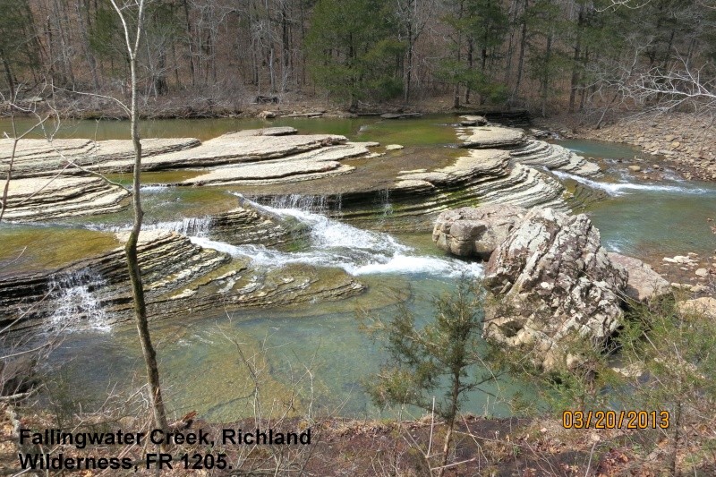
Beautiful stream side pictures, what a fine place to be enjoying the outdoors with a pipe by the fire. Awesome.
A
Anonymous
Guest
She must not appreciate you smoking in the tent :lol!:
:face:
:face:
docwatson
Well-known member
- Joined
- Mar 21, 2008
- Messages
- 1,676
- Reaction score
- 5
:lol!: :lol!: :lol!:RonA3597":dvpc5h44 said:Doc, maybe we dated the same woman over the years. She looks like my almost, but fortunately not, first wife. :affraid:
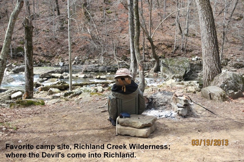
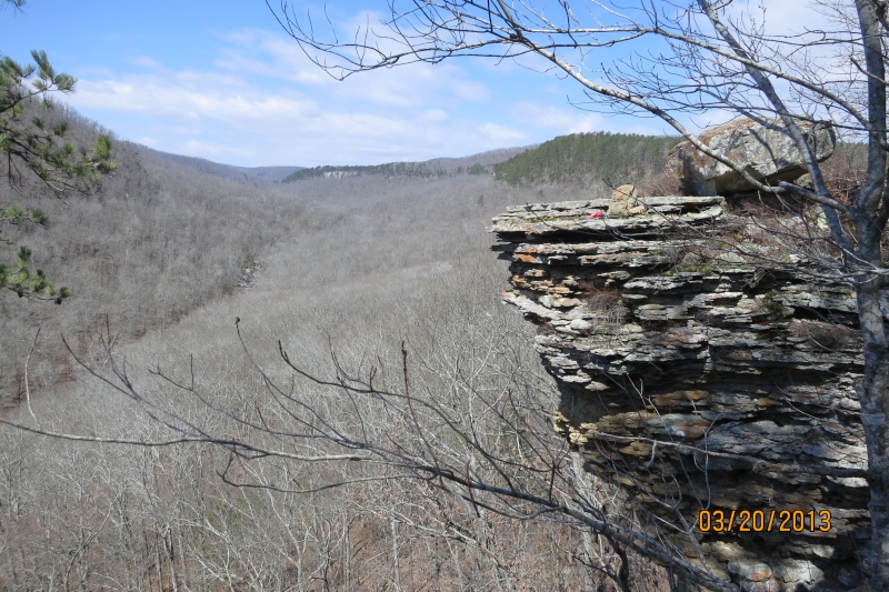
The Ozark National Forest has four wilderness areas, and Richland Creek is the second most beautiful, to me, and the one I know the best. Probably because it was the first one I ever explored when I first moved to Arkansas, and it's under two hours from my house. The most beautiful and wild, at least to me, is the Upper Buffalo Wilderness, which abuts the Buffalo River National Park. If you catch a good rain just right, you can paddle from Boxley to where the Buffalo meets the White River, over 120 miles of wild, protected river where you can camp anywhere, there are no fees, in that total 120 miles you see exactly four bridges and three buildings.
If I head West instead of Northwest, I can be in the Ouachita National Forest and they also have a couple of wilderness areas and it's even closer. In under an hour and a half I can leave home, park on a forest road, hike less than a quarter mile into the woods, and not see another person for months (if I could only stay there that long!). Another advantage of the Ouachitas, at least the Flat-side Wilderness, is it's also an hour and a half from my house and the forest road goes right next to Flat-side Peak, a quick 1/4 mile climb to the top and it's the darkest place I have found in Arkansas. You have an open vista from northwest clockwise to southwest, almost 270 degrees, and in that vista you can see two farmhouse lights about 15 to 20 miles away. The perfect place in winter to see a meteor shower, or full moon rise, or wave to the alien visitors as they fly by.
I generally prefer the Ozark Mountains (technically, the Ozark Plateau, they're not mountains) over the Ouachita Mountains (the remaining stumps of one of the oldest mountain ranges in North America, they were old and worn down before the Appalachians were uplifted). The Ozarks are chaotic in their drainage systems, formed from sedimentary layers, with alternating limestone and sandstone, so lots of caves, sink holes, dead-end hollows, springs, waterfalls, and some pretty good cliffs (one waterfall well over 200'). The Ouachitas are hard metamorphics and some igneous, so no caves or springs, and they run E & W (one of only two mountain ranges in North America that trend that way) resulting from the collision of two pronto-continents from the north and south that formed what we call the North American plate/continent today. If you're heading north or south, it's like an ant walking over a washboard, if you're heading east or west, you're probably on a hot, dry ridge-line. They do have Hot Springs National Park in them, and the only public diamond mine in the world. Creator of Diamonds State Park allows anyone to dig in the mud and keep what they find.
And yes, this will be on the test! (Can you tell I'm a teacher?!?)
Natch
docwatson
Well-known member
- Joined
- Mar 21, 2008
- Messages
- 1,676
- Reaction score
- 5
That is fantastic historical description, thanks for all. I don't think I'd like to venture out there in the winter time but the summer and fall must be beautiful. We have our wilderness here in Maine as well but not nearly as diversified as you have in the wilderness areas. It's great to enjoy pitch black nights when the constellations fire up the sky with no extraneous light from any surrounding civilation. I usually have a 38 strapped by my side in case of unwanted intruders. coyotes mainly.
dshpipes
Well-known member
- Joined
- Mar 6, 2011
- Messages
- 1,787
- Reaction score
- 0
Sounds absolutely incredible.
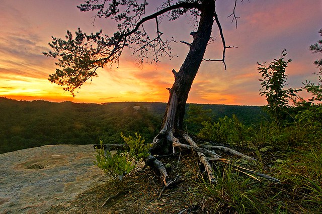
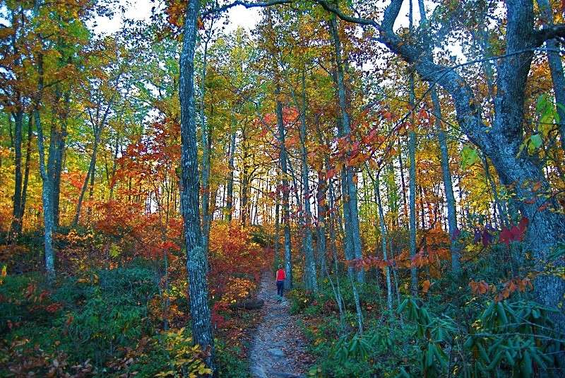
My favorite camping trip has to have been the 4 days I spent hiking through the Red River Gorge in eastern Kentucky with two of my dearest friends. Magical barely begins to describe the area. The first day we hiked in was great. The trail was fairly level with some gently ups and downs, including the occasional steep climb or rapid descend. On the whole, it was fairly relaxed. We spent the day hugged by nature and fell asleep content at the end of the day.
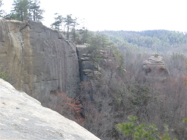
On day three we began a new trail, the advanced trail, which turned out to be much more grueling than the first. Long steep upward climbs were punctuated by fairly brief descents which just led to more upward climbing. At one point in the trail there is a deep pit that the trail descends into. The pit is open on one side and continues into the gorge at the bottom. While we were there, we did a fun experiment. My friends both play the flute and brought them along for the hike for some music in the evenings. Realizing an excellent opportunity when they see one, they both pulled out their flutes to take advantage of the high flat cavern walls. All of those hard, flat surfaces acted as an excellent source of reverb, creating a beautiful ethereal sound whose source was difficult to pinpoint. Realizing this, my friends ducked climbed into an outcropping above the trail which was out of sight and played some magical pan flute tunes for other hikers who were descending into the pit. We spent a good hour there singing and making music, climbing around, and just having a generally goofy good time. After the end of the day, we crashed into our sleeping bags exhausted but with our spirits high from a tough but fun day of hiking.
On day 4, we made a torturous climb out of the gorge and emerged onto a ridge, gracing us with an incredible 360 view for the remainder of the hike. Blue skies and calm winds made the last portion of the hike a joy. With excellent weather, incredible views, and some flat hiking atop the ridge, we ended our journey with high spirits and happy memories.
I've promised myself again and again that I'd go back, but life seems to keep getting in the way. *sigh* One day.
I didn't take these pictures, but they do a great job representing the gorge.
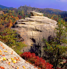
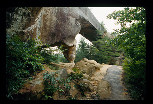
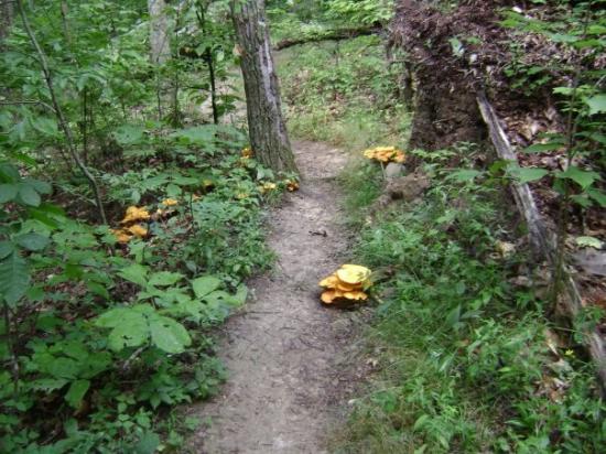
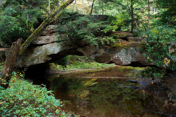


beetlejazz
Well-known member
- Joined
- Aug 17, 2012
- Messages
- 691
- Reaction score
- 0
Whoa, Uber, what a bunch of awesome pics, awesome sceneries & and an awesome story to go with them! Daaaamn you guys are really making me ache to get out. Sadly I don't currently possess the sort of equipment I could comfortably camp with as long as there's snow on the ground. But it will melt, it will melt...
Here's a feel-good picture from last summer, when I spent a few days in Ruunaa (an area with lakes, marshlands and beautiful roaring rapids) with my brother. This night was all rain and lightnings but in the end of the day there was a nice little lean-to for cover and enough Rhum Pecoul to last for the night. And a pair of knit socks, of course!

Here's a feel-good picture from last summer, when I spent a few days in Ruunaa (an area with lakes, marshlands and beautiful roaring rapids) with my brother. This night was all rain and lightnings but in the end of the day there was a nice little lean-to for cover and enough Rhum Pecoul to last for the night. And a pair of knit socks, of course!

dshpipes
Well-known member
- Joined
- Mar 6, 2011
- Messages
- 1,787
- Reaction score
- 0
Ah, knit socks and a bottle of rum, prerequisites for any successful night of camping.beetlejazz":sqecunfc said:Whoa, Uber, what a bunch of awesome pics, awesome sceneries & and an awesome story to go with them! Daaaamn you guys are really making me ache to get out. Sadly I don't currently possess the sort of equipment I could comfortably camp with as long as there's snow on the ground. But it will melt, it will melt...
Here's a feel-good picture from last summer, when I spent a few days in Ruunaa (an area with lakes, marshlands and beautiful roaring rapids) with my brother. This night was all rain and lightnings but in the end of the day there was a nice little lean-to for cover and enough Rhum Pecoul to last for the night. And a pair of knit socks, of course!



![[3-Size Set] Copper Pipe Cleaner for Drill, Clean 1/2, 3/4, 1-in Copper Pipes & Tubes for Soldering, 3 Tube Cleaning Brushes, Model InerLok050, 075, 100, w/ Stainless-Steel Wire Bristles & 1/4” Shank](https://m.media-amazon.com/images/I/41FEqUv4rNL._SL500_.jpg)


